

Larchmont: Details on historic maps
Scroll through the maps below of what is now Larchmont that date back to 1797, for details.
Then, go here to zoom in on those historic Larchmont maps.
See other historic maps:
• Mamaroneck
• Rye Neck
More resources
Westchester County Archives Digital Collection: Countywide maps and atlases, photographs and more
Westchester County Historical Society: Images, objects and more
Westchester County Historical Aerial Photographs collection: Photos taken from airplanes between 1925 and 1995.
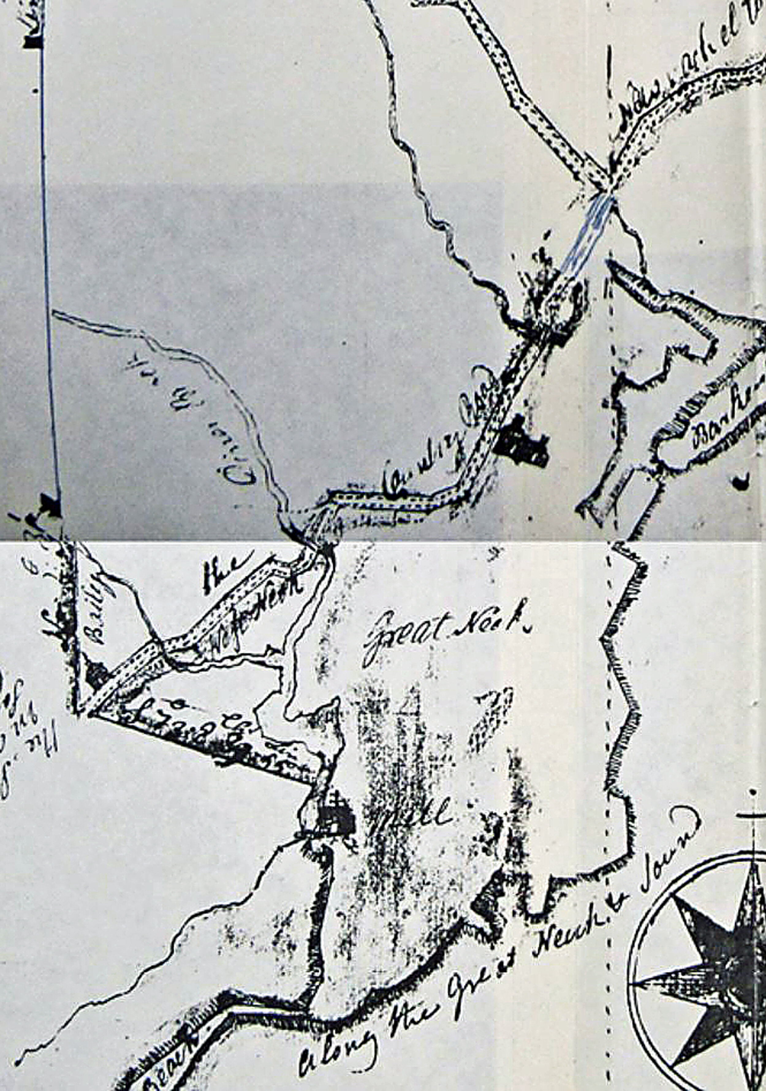
1797: Larchmont below the Post Road is labeled “Great Neck” in this part of a surveyor’s map of Mamaroneck Town, from the Westchester County Historical Society/Archives collection. See the full 1797 map of Mamaroneck Town.
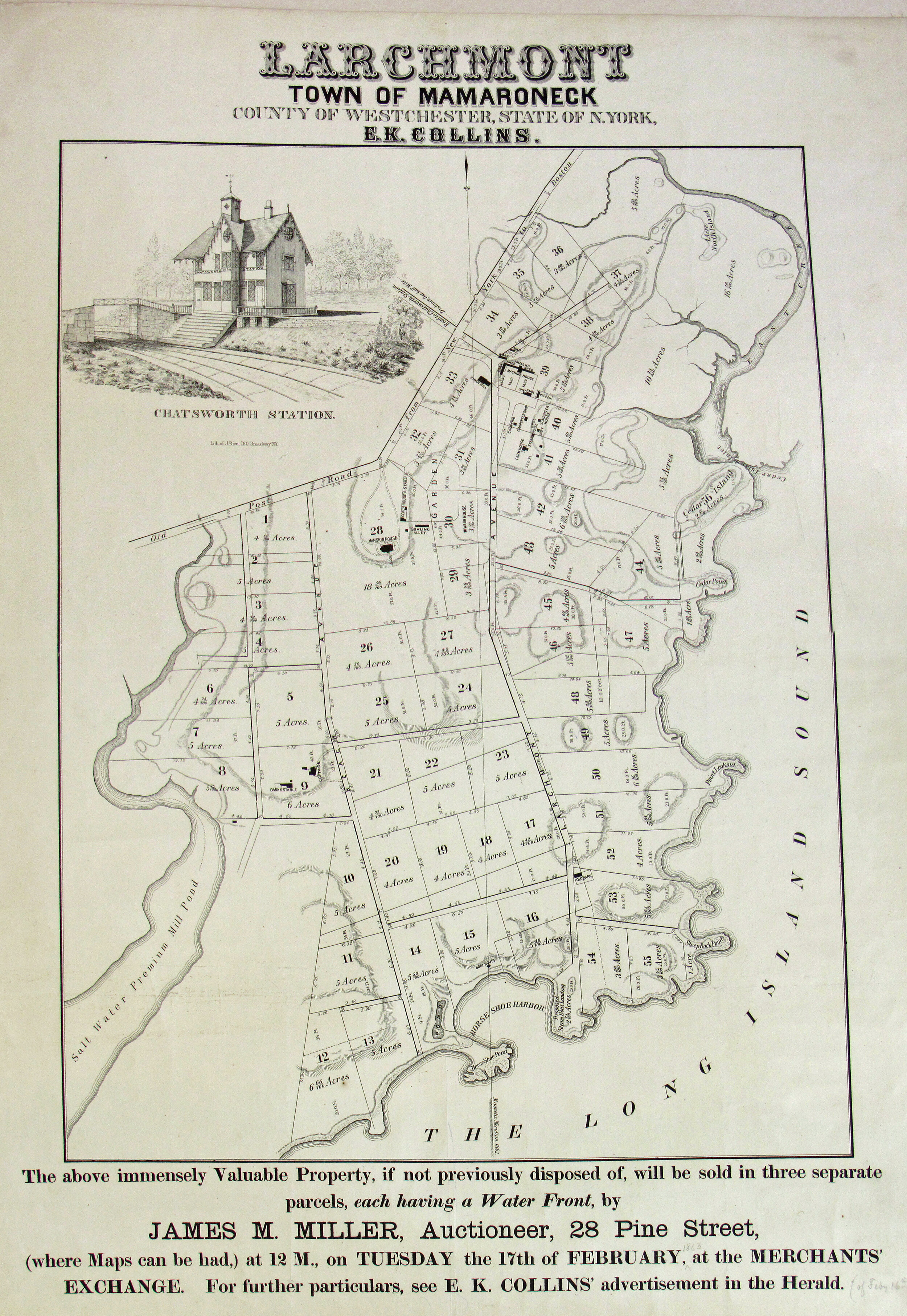
1863: Map prepared for an auction of Larchmont property, from the Westchester County Historical Society/Archives collection.
1868: From the Mamaroneck Historical Society collection. See the full Mamaroneck Town-Larchmont map.

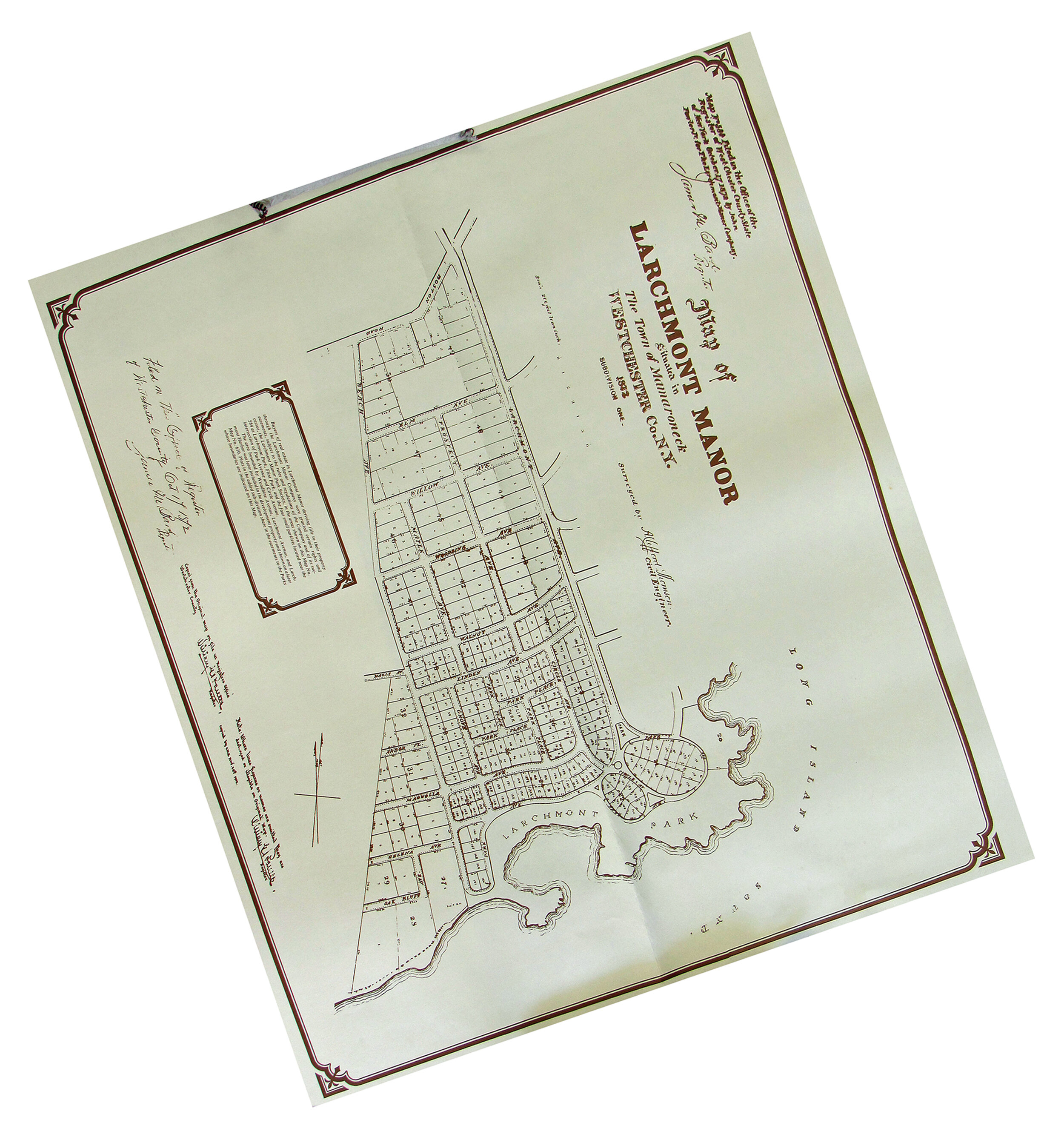
1872: Surveyor’s map filed with Westchester County by the Larchmont Manor Company, from the Westchester County Historical Society/Archives collection.

1872 - Aligned so north is up
Map is aligned so north is up
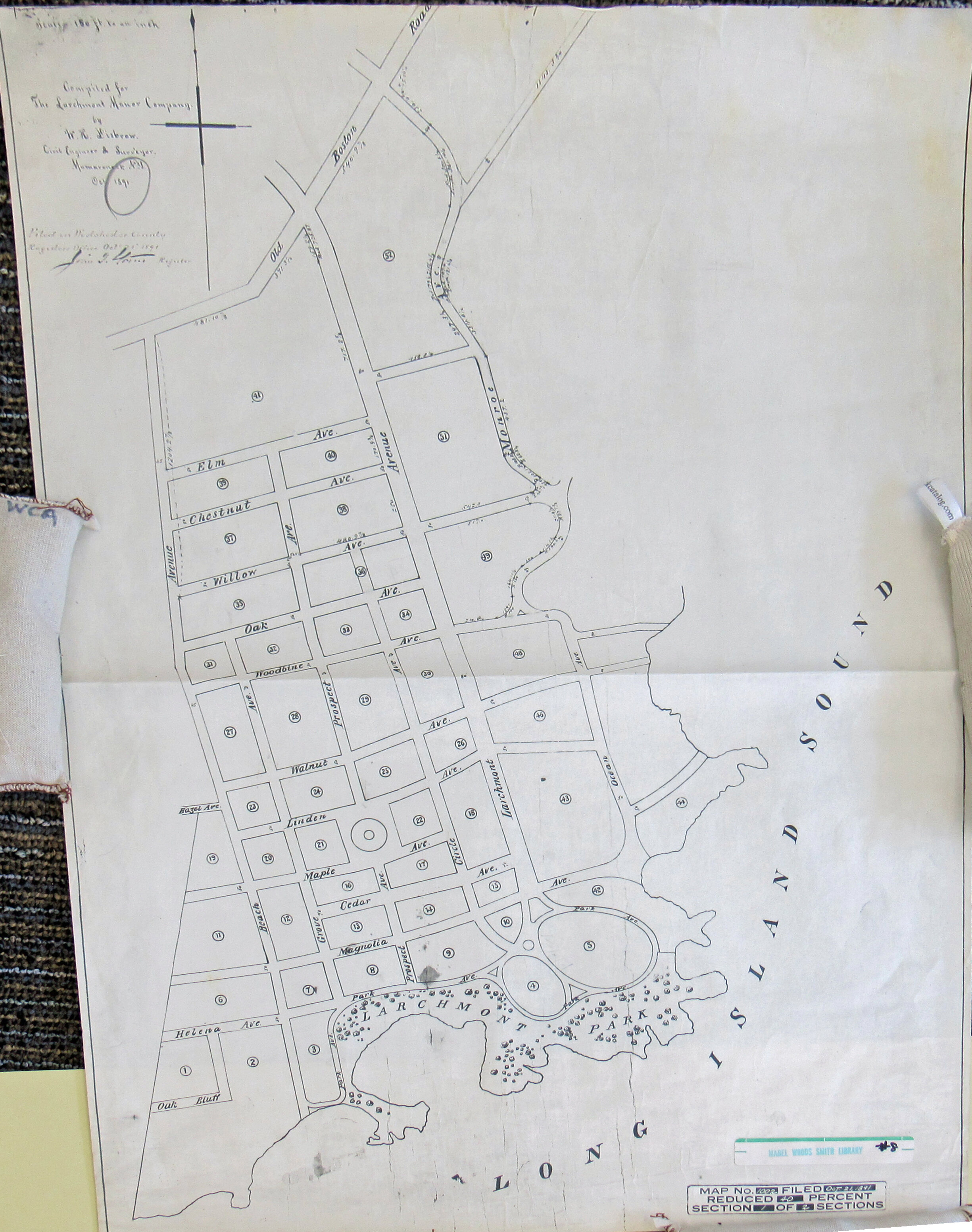
1891: Created for the Larchmont Manor Company, in the Westchester County Historical Society/Archives collection.
1911: From G.W. Bromley and Co.'s 1910-11 Atlas of Westchester County posted online by the Westchester County Archives.

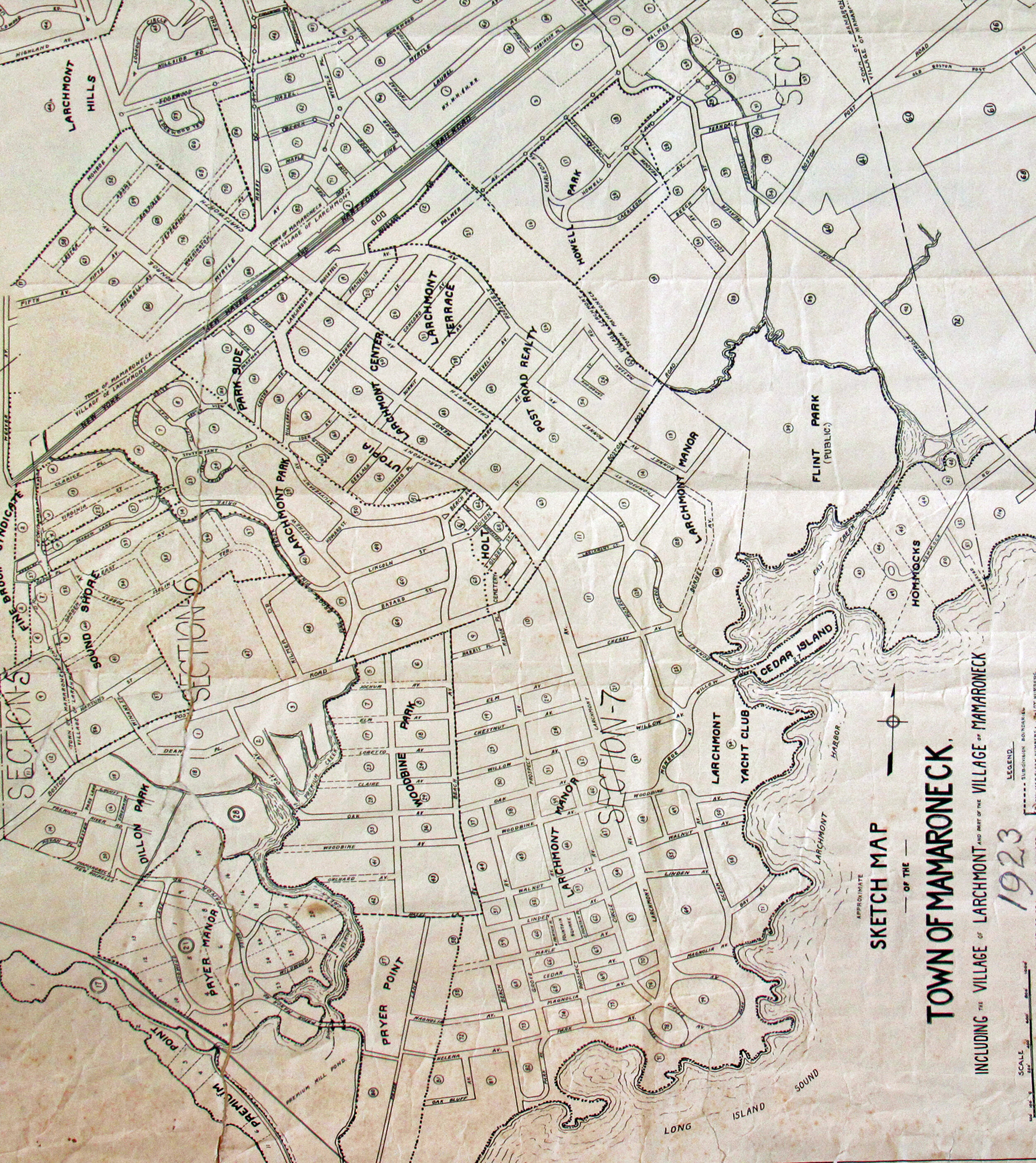
1923: From the Westchester Historical Society/Westchester Archives collection. See map right side up, next.
Map is aligned so north is up
1923 in its original alignment

1929 (part, Atlas of Westchester County by G.M. Hopkins Co., Westchester County Archives).

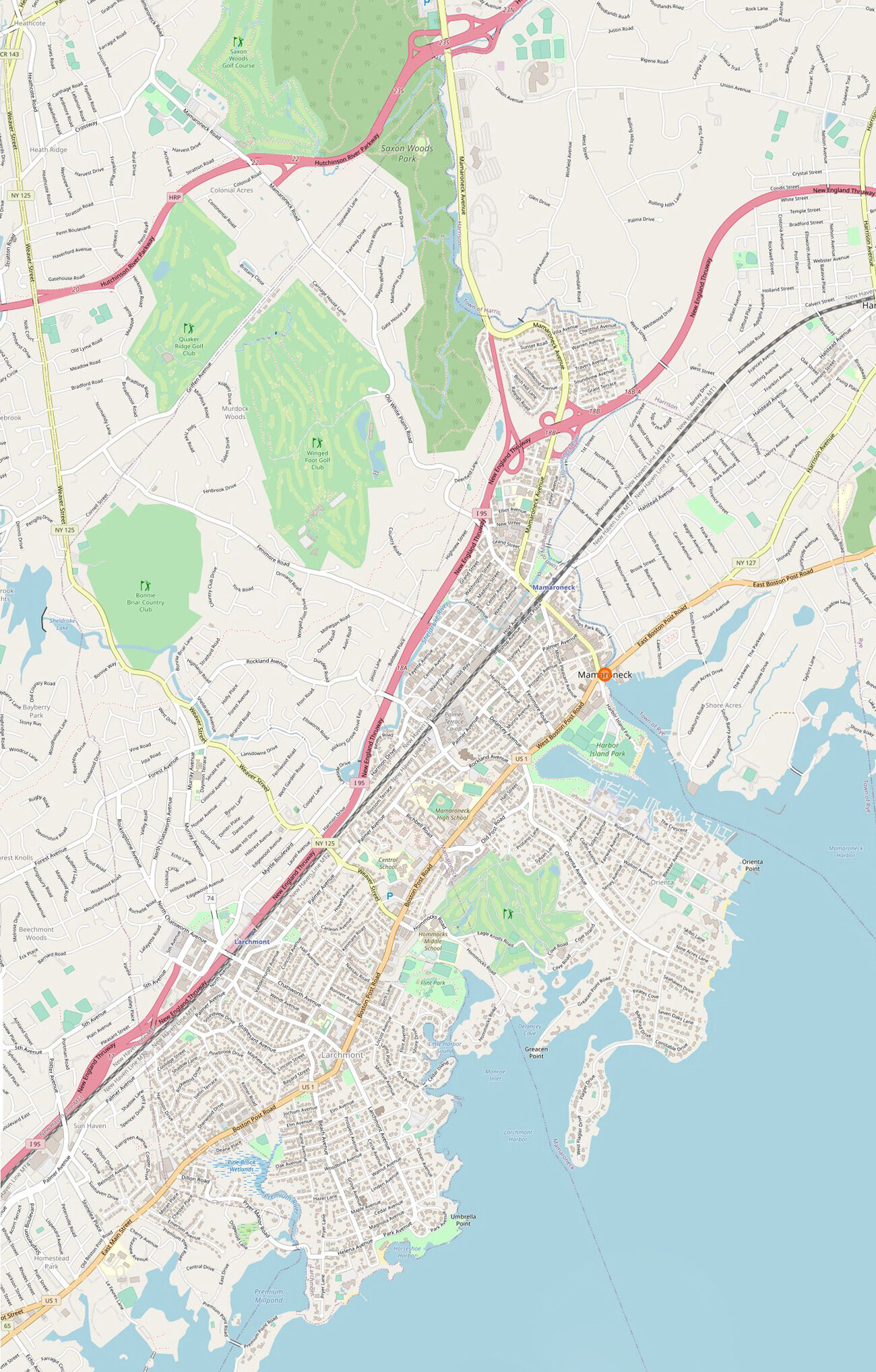
Today: From Open Street Map
Go here to zoom in on those historic Larchmont maps.
See other historic maps:
• Mamaroneck
• Rye Neck
More resources
Westchester County Archives Digital Collection: Countywide maps and atlases, photographs and more
Westchester County Historical Society: Images, objects and more
Westchester County Historical Aerial Photographs collection: Photos taken from airplanes between 1925 and 1995.