
Historic maps info: Details on Mamaroneck maps
Background on Mamaroneck maps 1774-present
Scroll through the maps below. Then, go here to zoom in on those Mamaroneck historic maps
See other historic maps:
• Larchmont
• Rye Neck
More resources
Westchester County Archives Digital Collection: Countywide maps and atlases, photographs and more
Westchester County Historical Society: Images, objects and more
Westchester County Historical Aerial Photographs collection: Photos taken from airplanes between 1925 and 1995.
1774: Mamaroneck part of Caleb Heathcote’s properties (overlaid on modern map)
The “Heathcote” map showing the Mamaroneck portion of Caleb Heathcote Esq.’s properties, overlaid on a present-day map for context.. See the complete Heathcote map of his properties in Mamaroneck, Scarsdale and Harrison, next. From the Westchester County Historical Society/Archives collection.
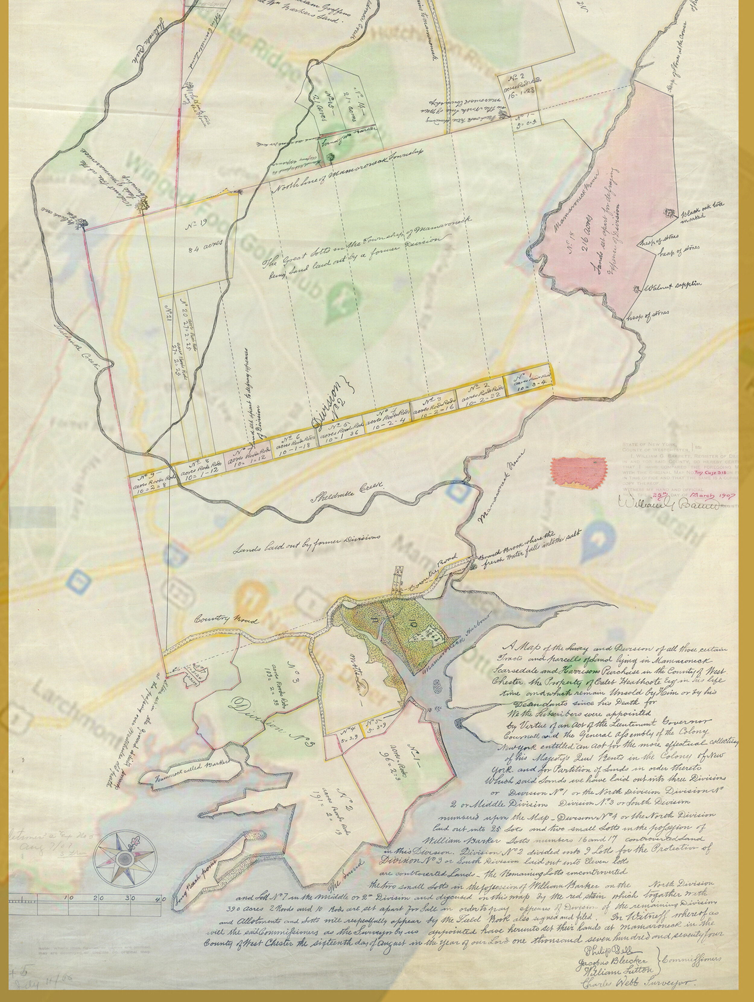
1774: Full map of Caleb Heathcote’s properties in Mamaroneck, Scarsdale, Harrison

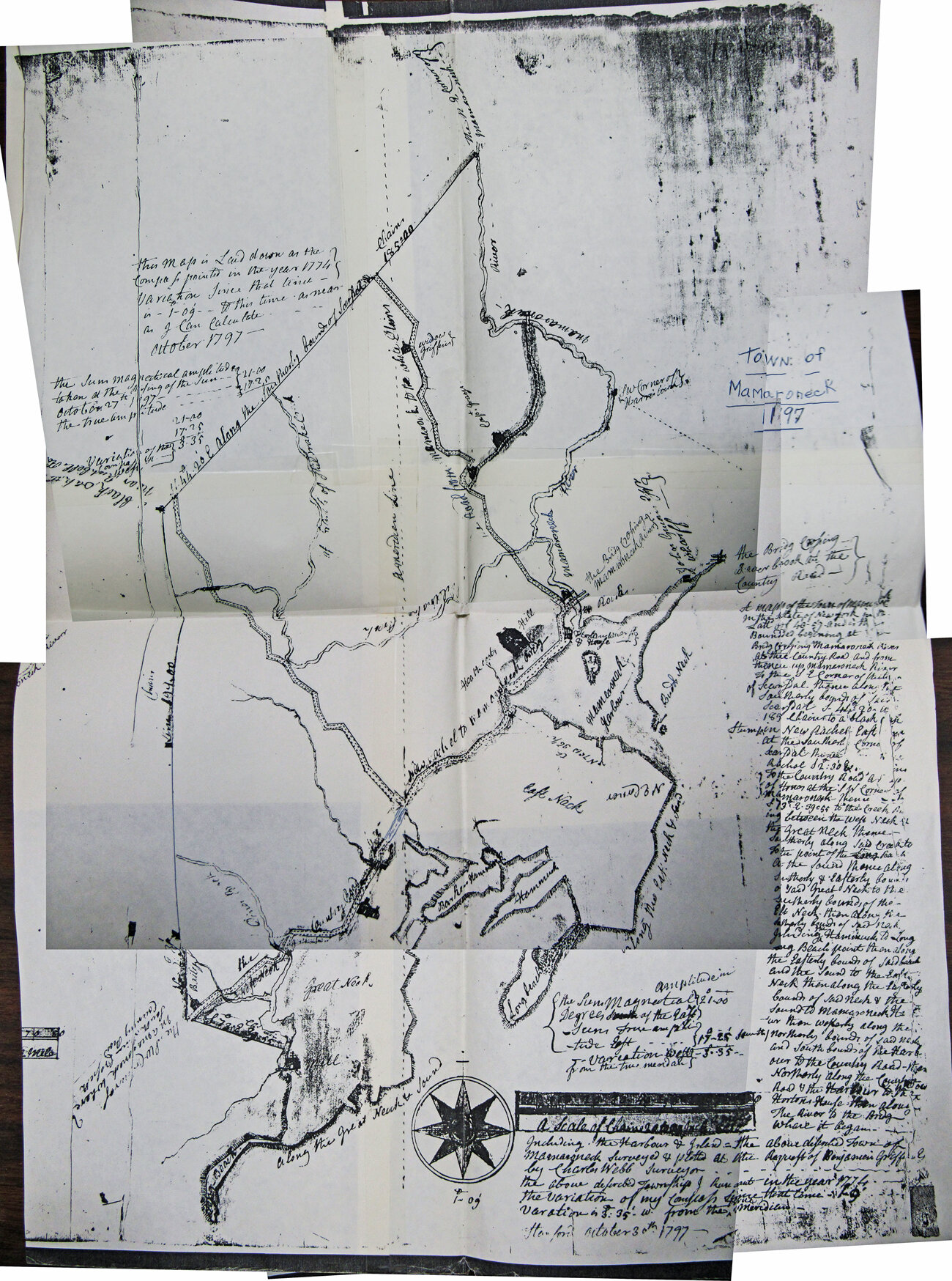
1797: A surveyor’s map of Mamaroneck Town, from the Westchester County Historical Society/Archives collection.
1820: From the Westchester Historical Society/Archives collection. Angled street at left is Mount Pleasant Avenue running from Boston Post Road - “Turnpike” - bottom, to Mamaroneck Avenue - “White Plains road” - top. The 1816 schoolhouse, now in Harbor Island Park, is noted where Mount Pleasant Avenue and Mamaroneck Avenue meet. See the map right side up, next.

1820 right side up. Mamaroneck Avenue -“White Plains road” is at the bottom in this view.

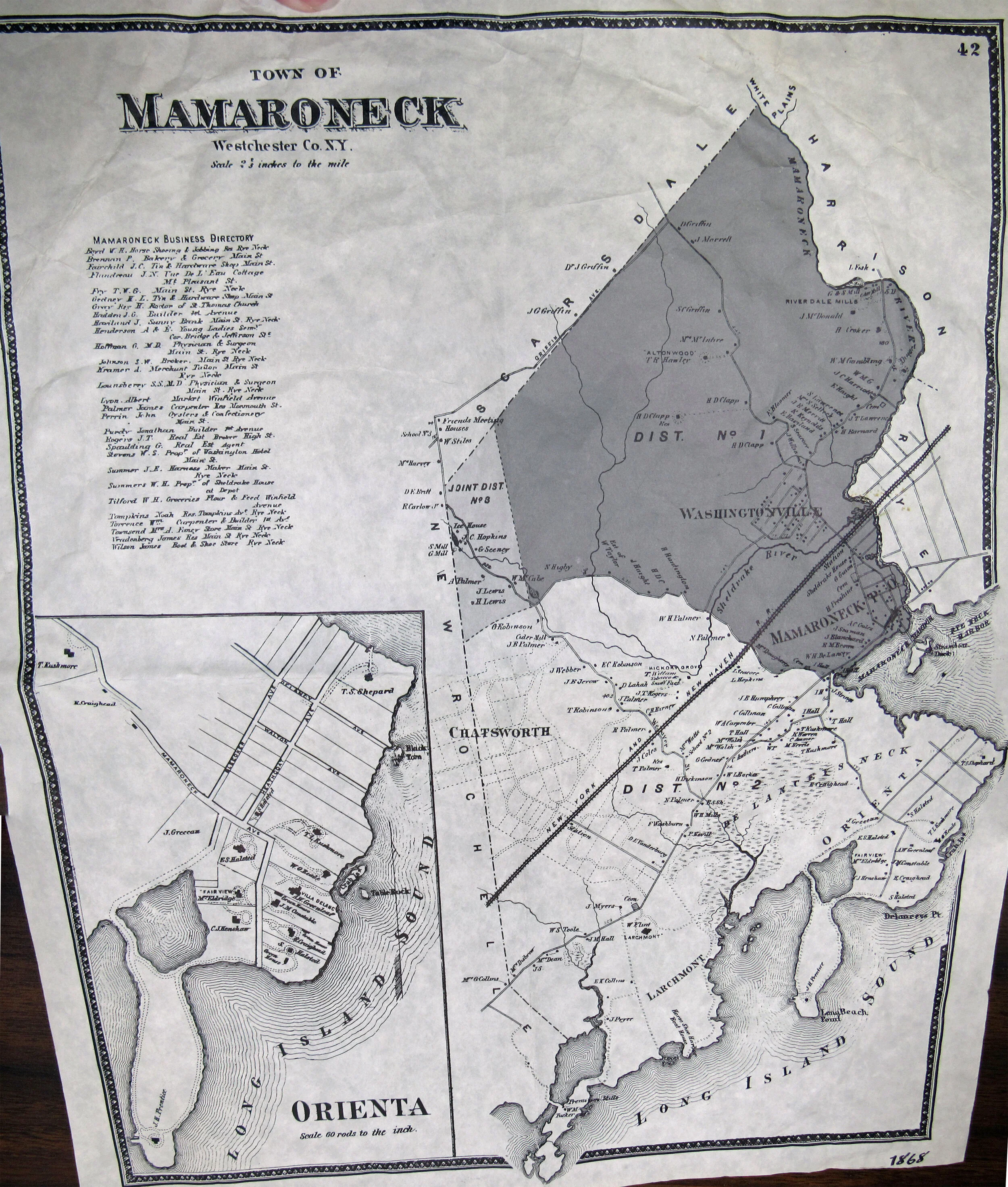
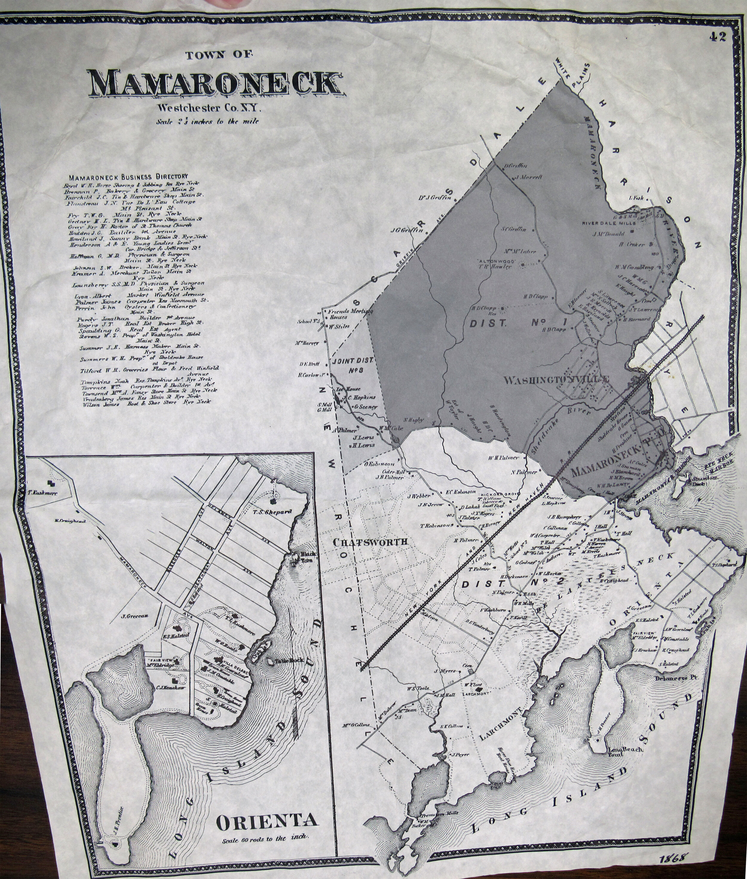
1868: From the Mamaroneck Historical Society collection
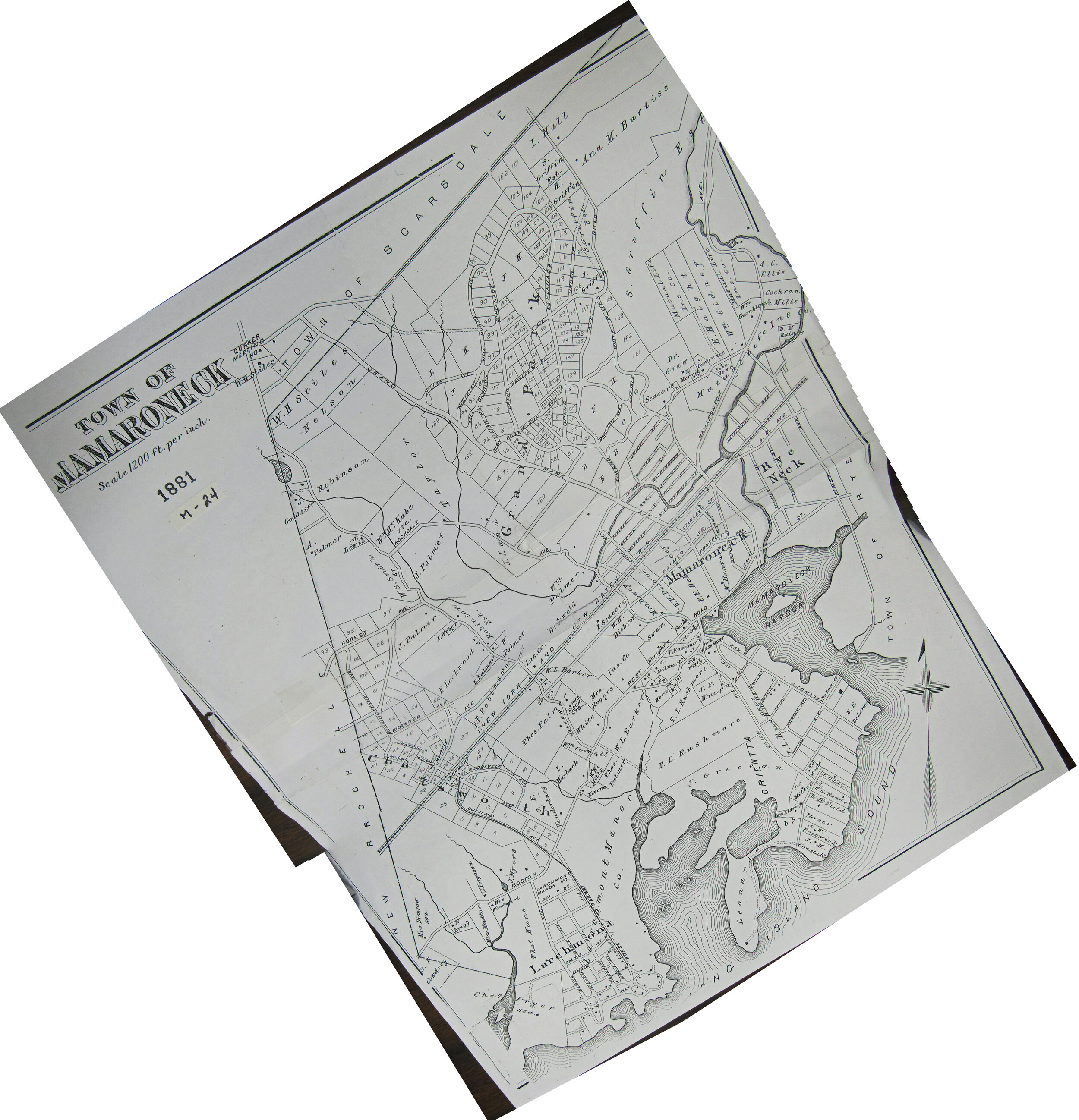
1881: From the Mamaroneck Historical Society collection
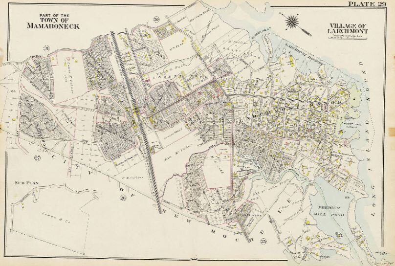
1911: From Bromley’s Atlas of Westchester, posted online by the Westchester County Archives
1923: From the Westchester Historical Society/Westchester Archives collection.
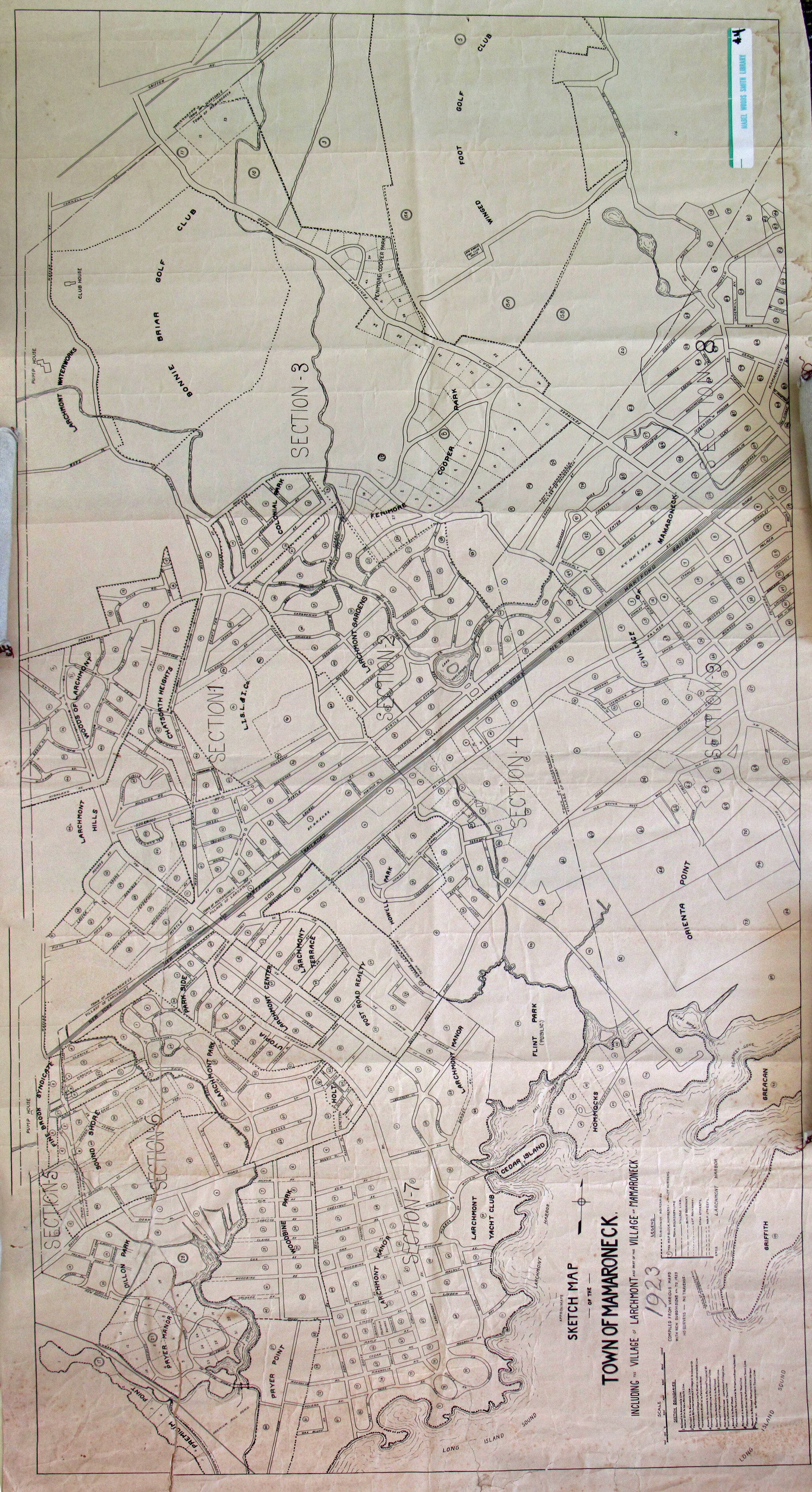
1923 map is aligned so north is up
1923: Right side up. North is to the right. From the Westchester Historical Society/Westchester Archives collection.

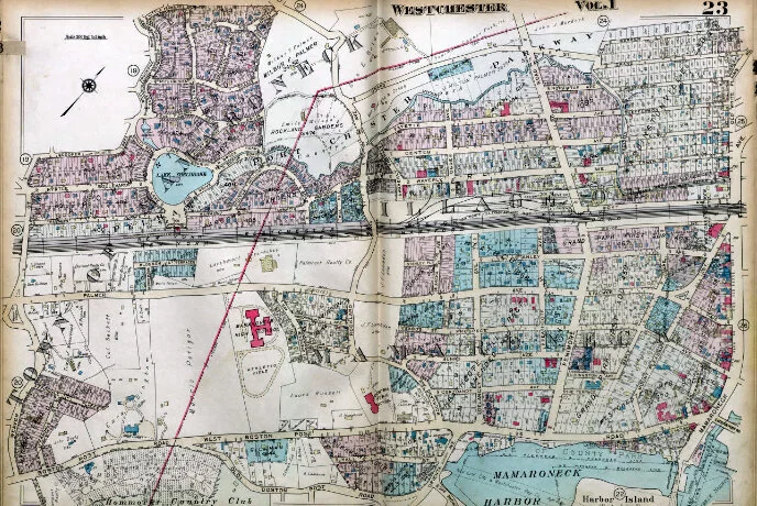
1929: From G.W. Hopkins Co.’s Atlas of Westchester County, posted online by Westchester County Archives
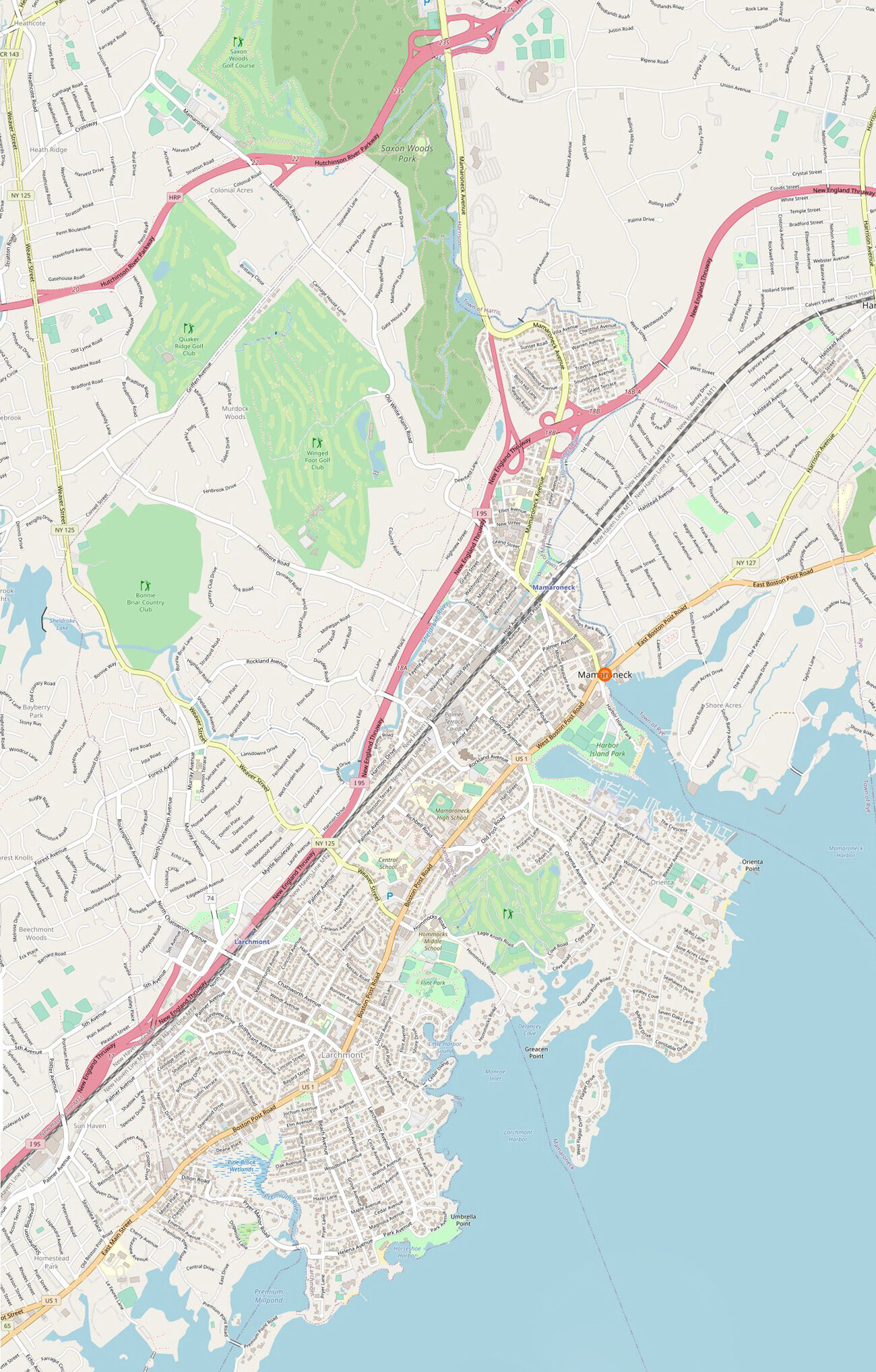
Mamaroneck today: From Open Street Map
Go here to zoom in on Mamaroneck historic maps
See other historic maps:
• Larchmont
• Rye Neck
More resources
Westchester County Archives Digital Collection: Countywide maps and atlases, photographs and more
Westchester County Historical Society: Images, objects and more
Westchester County Historical Aerial Photographs collection: Photos taken from airplanes between 1925 and 1995.