
Historic maps info: Rye Neck 1772-present
Details on Rye Neck maps
View maps and background below. Then, go here to zoom in on those Rye Neck historic maps.
See other historic maps:
More resources
Westchester County Archives Digital Collection: Countywide maps and atlases, photographs and more
Westchester County Historical Society: Images, objects and more
Westchester County Historical Aerial Photographs collection: Photos taken from airplanes between 1925 and 1995.
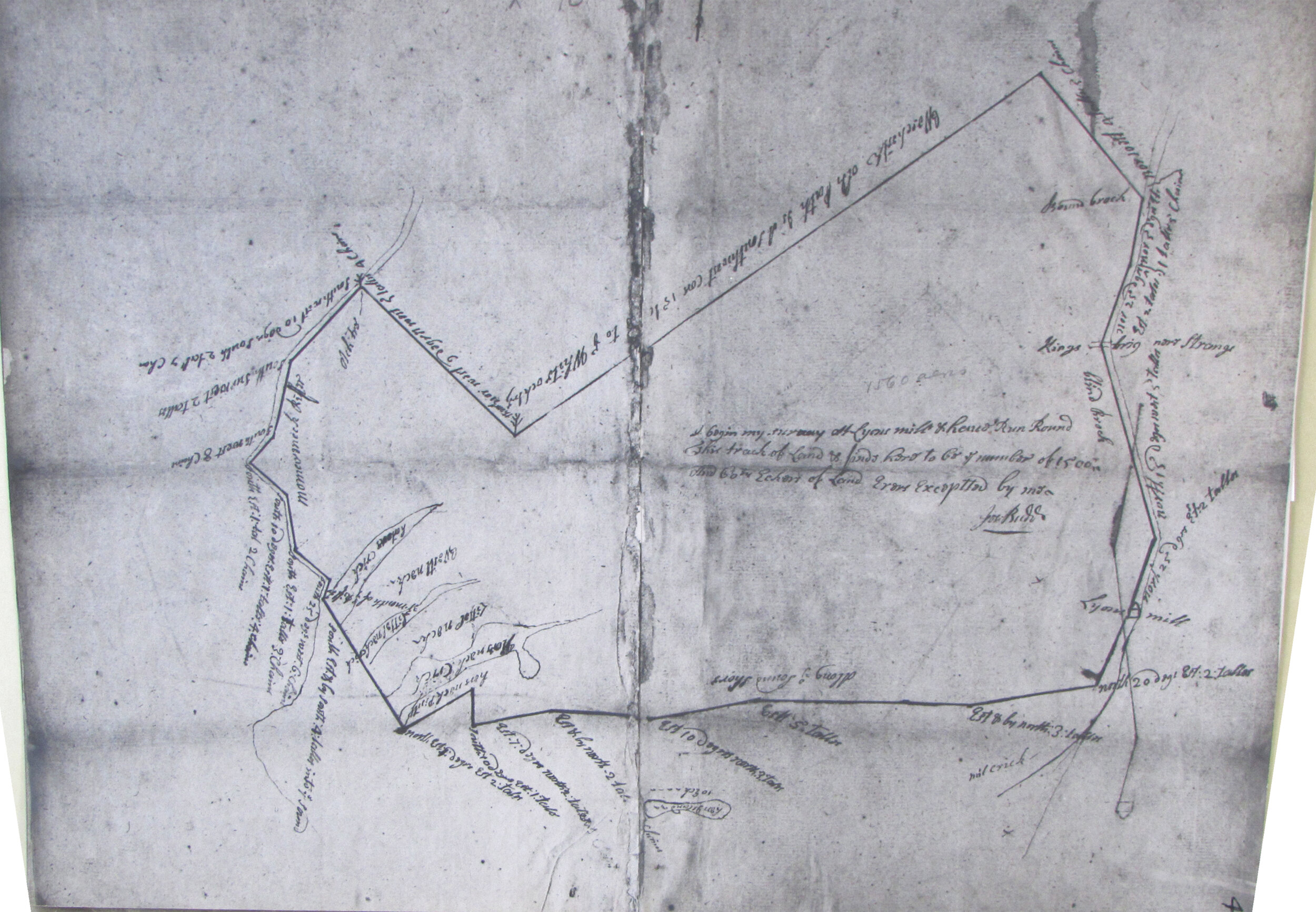
1772: Surveyor's map from the Westchester County Archives collection. We've overlaid the map, approximately, on a current map to provide context and labeled key features for legibility.

1772: Unlabeled version
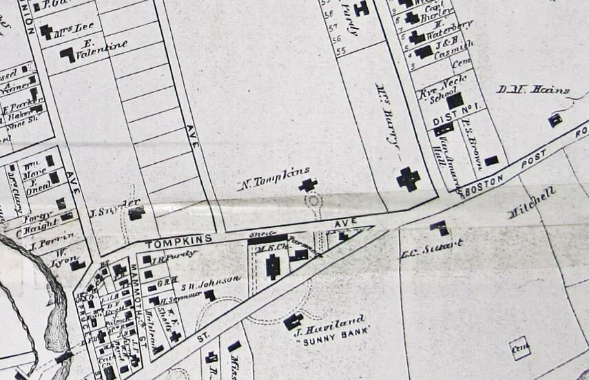
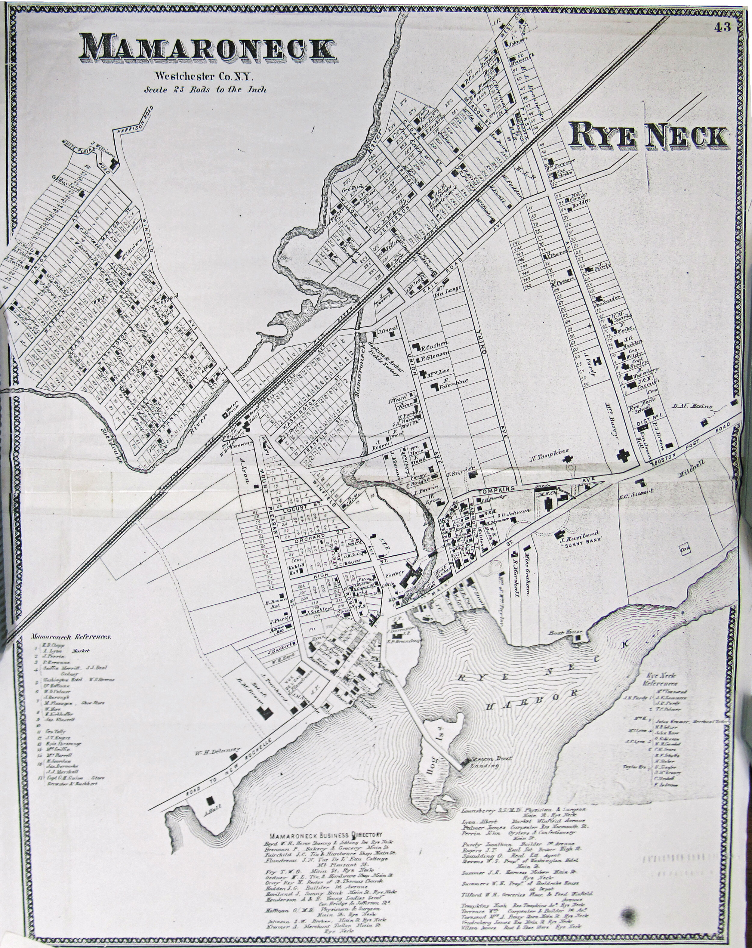
1868: From the Mamaroneck Historical Society collection. See an 1867 Rye Neck/Mamaroneck map from the F.W. Beers Atlas of Westchester County online at the Westchester Archives.
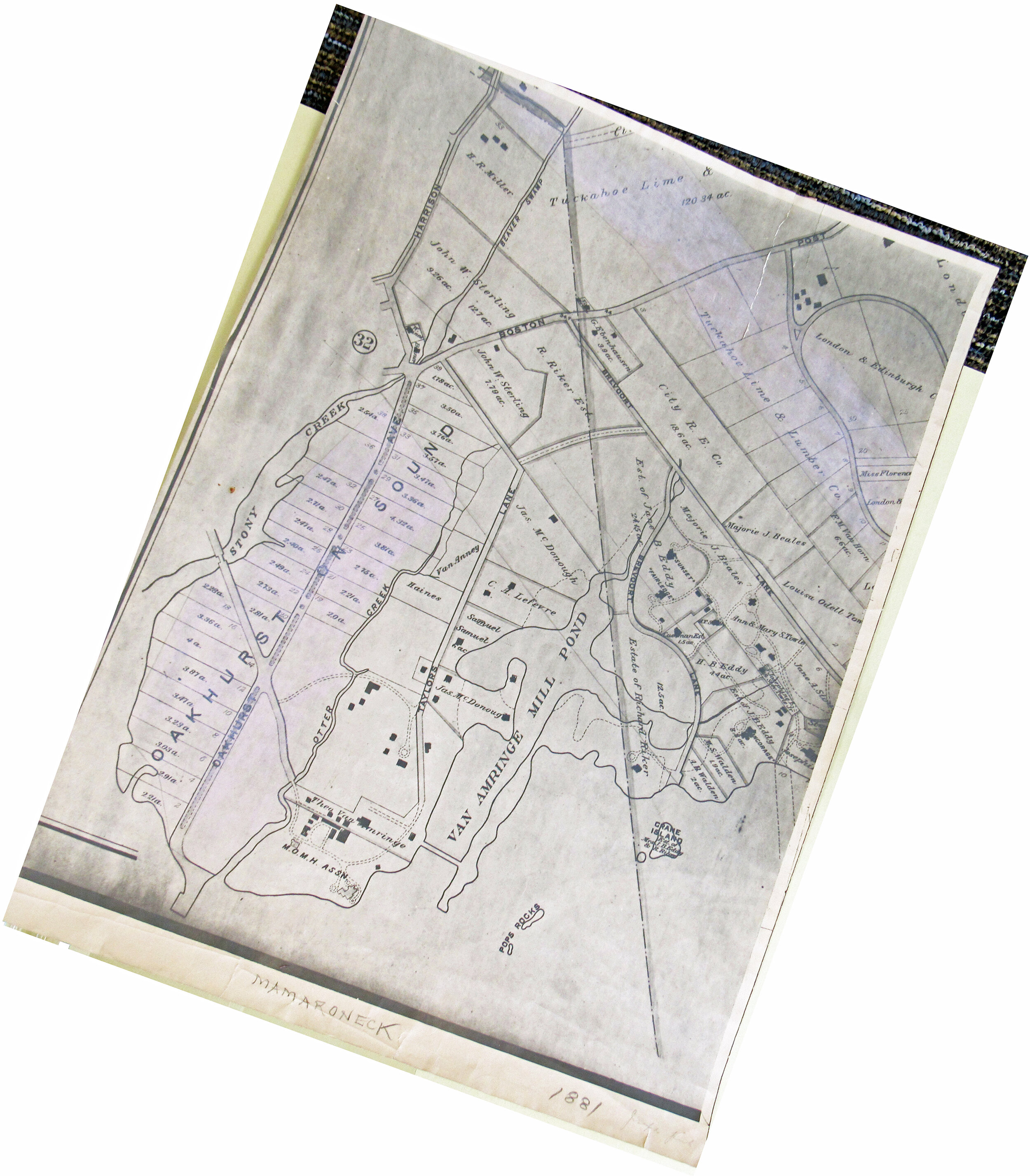
1881 (Shore Acres): From G.W. Bromley's Atlas of Westchester County in the Westchester County Archives collection.
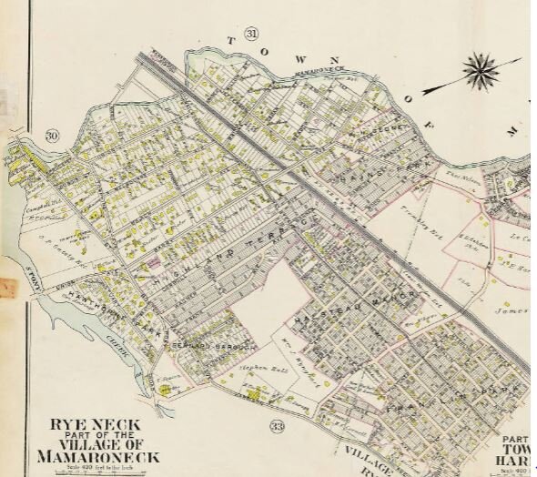
1911 (Rye Neck, part) From G.W. Bromley and Co.'s 1910-11 Atlas of Westchester County posted online by the Westchester County Archives.
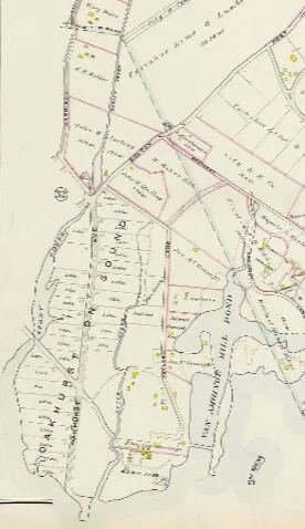
1911 (Shore Acres, part) From G.W. Bromley and Co.'s 1910-11 Atlas of Westchester County posted online by the Westchester County Archives.
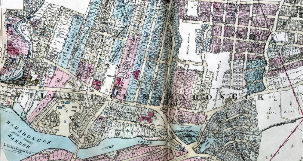
1929 (part): G.W. Hopkins Co.’s 1929-31 Atlas of Westchester County, posted online by Westchester County Archives,
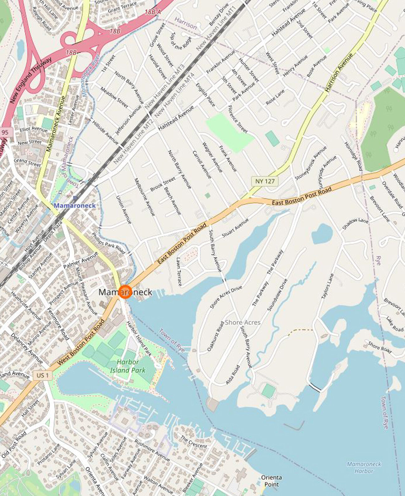
Rye Neck today: From Open Street Map
Go here to zoom in on those Rye Neck historic maps
See other historic maps
More resources
Westchester County Archives Digital Collection: Countywide maps and atlases, photographs and more
Westchester County Historical Society: Images, objects and more
Westchester County Historical Aerial Photographs collection: Photos taken from airplanes between 1925 and 1995.